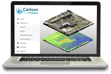
Carlson Photo Capture Online
$199.00 – $2,995.00
Carlson Photo Capture Online (Cloud Service)
Carlson PhotoCapture online may be used on any device with access to the internet. All that’s required is a yearly membership and the purchase of processing capacity as needed. No minimum monthly fees, and projects may be shared for collaboration with coworkers and clients.
See Available Discounts in Cart
Description
Overview
Aerial surveying and drone photogrammetry is rapidly becoming a vital part of any surveyor’s toolkit. Thousands of people use drone site flyovers every day to help boost efficiency and lower costs.
With Carlson PhotoCapture drone photo processing software, you can use flyover data to:
- Quickly generate interactive 3D maps of sites
- Capture highly accurate 3D site data in point clouds, orthophotos, and more
- Integrate LiDAR data from aerial or ground sources into photogrammetry projects
- Share site maps with customers – anywhere, anytime!
- Save man-hours in the field
Our proprietary technology helps you track and share every metric about your site from anywhere in the world. PhotoCapture is available both as a cloud-based service at photocapture.carlsonsw.com and as a standalone desktop application.
Project Creation
- Polygon Selection/Removal of unwanted images with a click of a button
- Project Splitting with Polygon Selection Tool (Large project into small projects)
- Visualize project area before processing
- Ground Control Point (GCP) import (landxml,.csv, .txt)
- Manual Ground Control Point input
- Ground Control Point Validation
- Metric, Feet, and US Survey Feet support
- Global/Local Coordinate System Support (thousands of supported projections)
Project Processing
- Nadir/Oblique Support
- Self-Calibration – Automatic Determination of Camera IOP and EOP
- Fixed-Calibration – Use your own calibration parameters for processing
- Automated Bundle Adjustment
- Automated Point Cloud Densification
- Automated DEM Generation
- Automatic Contour Generation
- Automatic Mesh Generation
- Automaic Orthomosaic Generation
- Accuracy Report
Project Outputs
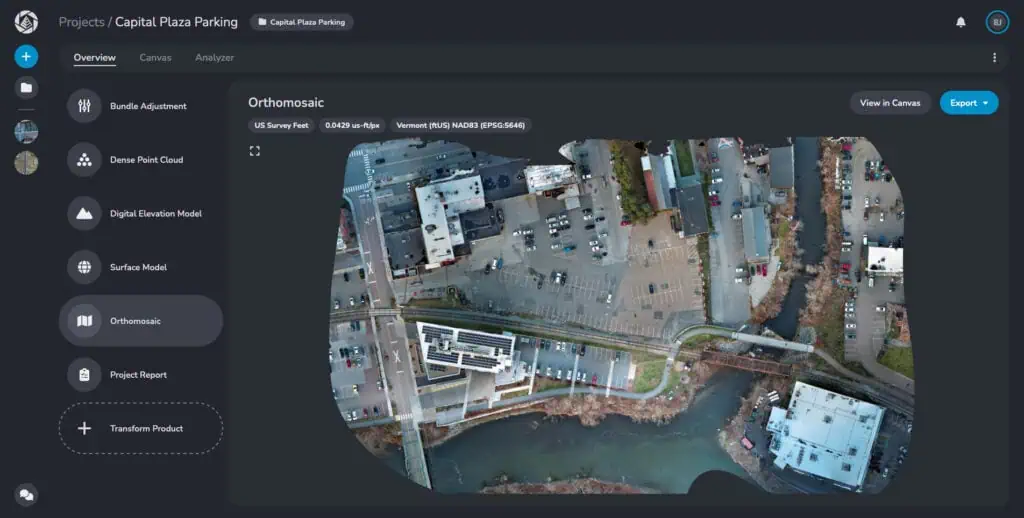
- Orthomosaics in GeoTIFF, jpg, png output format
- DEM in Geotiff, jpg, png output formats
- 3D point cloud in .las, .xyz, and .ply
- 3D mesh in .ply, .obj, and .glb formats
- Contours in .dxf, GeoTIFF formats
- Accuracy Report in PDF format
- In-Browser Volume Calculations
Collaboration
- Web visualization of all data products
- Visualize 2D maps and 3D models using any web browser
- Cesium 3D Tile Integration
- Instant measurement of distances and surfaces
- Share Projects with annotations via a simple link
- Embed project output in a webpage
- Visualize Site Changes over Time in 2D and 3D with Project Timeline
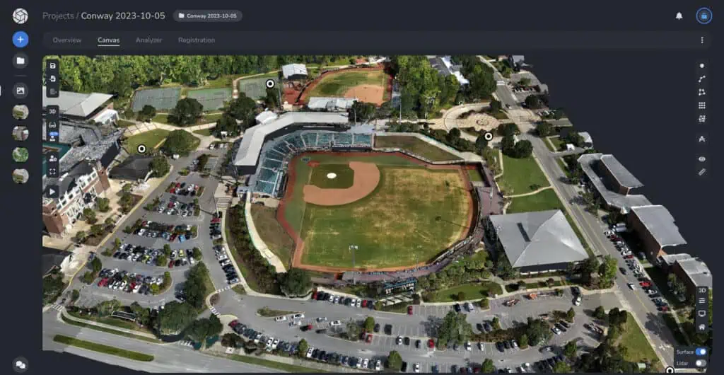
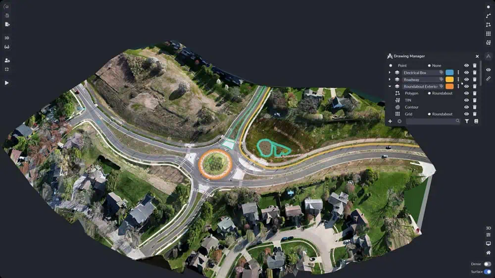
The Survey Canvas
Available in PhotoCapture Web and PhotoCapture Standalone Advanced, the Survey tab is a 3D workspace to analyze and annotate your data set, and offers a number of powerful tools and abilities, including:
- Create 3D points, polylines and polygons
- Measure distance, area and volume
- Create grids, TINs, contours and profiles
Features
Key Features:
- Sparse or Dense point clouds
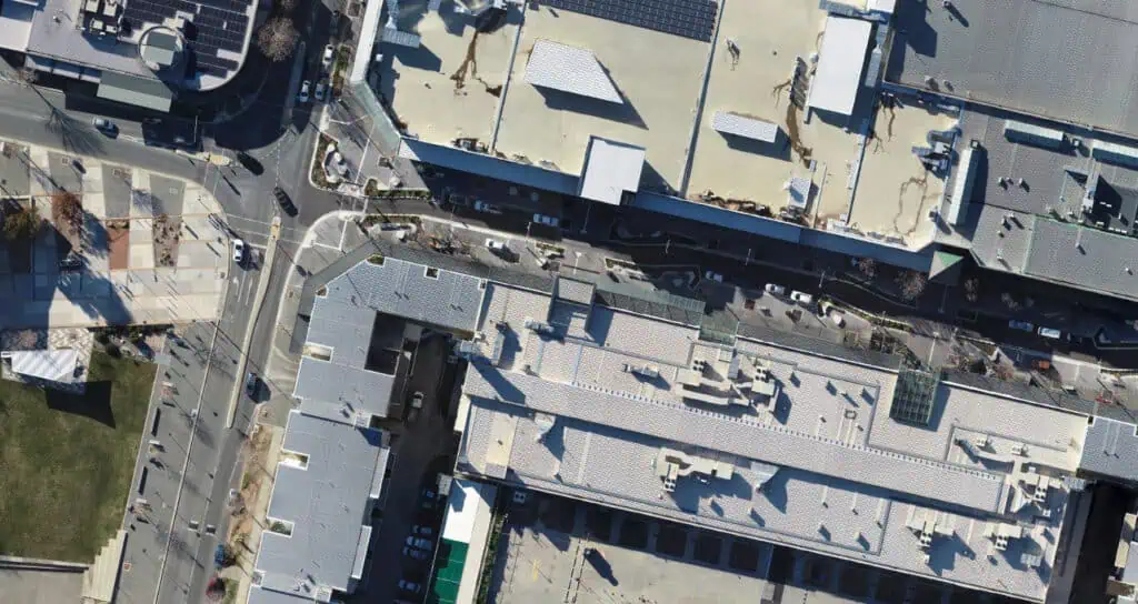
- Orthoimages
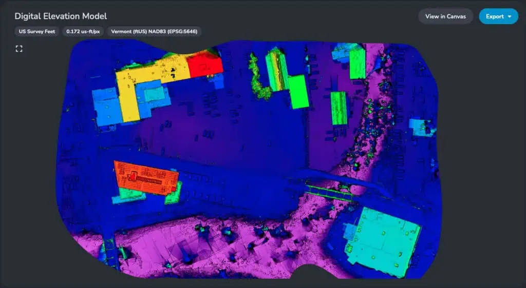
- Digital Elevation Models
- Project Quality Reports
- Survey Canvas – Virtual Drafting
- Work on 2D image or 3D mesh
- Import data via CAD, PDF, LandXML and other formats
- Calculate distances, areas, and volumes
- Create points, linework, grids, tins, and contour lines
- Import Carlson Field-to-Finish code files
- Export coded data to quickly create deliverables in Carlson office software
- Export in a wide variety of file formats
- Live Help Chat
Videos
Screenshots
System Requirements
PhotoCapture Web
PhotoCapture Web’s unique pricing structure allows you to maximize your ROI by only purchasing the data you need.
Step 1: Membership
Gain access to Carlson PhotoCapture for $150 a year
Step 2: Add processing capacity
5GB-$199
50GB-$995
150GB-$1990
For processing needs over 150GB, contact our sales department.
Free Support
Carlson Software Works For You
A customer’s relationship with Carlson Software goes beyond simply purchasing our software – with Regional Managers throughout the country, free technical support for life, and training options for any budget – we’ve got you covered!
Direct Technical Support
- Hours: Monday – Friday, 8:00 AM – 6:00 PM (EST)
- E-mail: moc.wsnoslrac@troppus
- Problems/Suggestions: Send in a report
- Telephone: 606-564-5028
- Fax: 606-564-6422